

Two storm remnants, two very different corners of the country, one soggy Sunday. Out West, the leftovers of Post-Tropical Cyclone Rachel are dumping rain on Southern California and the desert Southwest. Back East, the remnants of Isaias are drenching the Washington, D.C. region. If you’re checking the forecast and trying to figure out what a flood warning actually means for you, here’s the plain-English rundown.
Post-Tropical Cyclone Rachel: what’s happening in the West
Rachel has been a rare visitor for this part of the country. Forecasters said the system was due to make landfall in Mexico, just south of the U.S. border, late Saturday night, with its post-tropical remnants then spreading heavy rain across Southern California and into southern Nevada, including Las Vegas, on Sunday.
The big worry is how fast the rain could fall. The FOX Forecast Center warned that months’ worth of rainfall could arrive in just a few hours, with the greatest flooding concern stretching from Riverside County in California into northwest Arizona, southern Nevada and the slot canyon country of southwest Utah. CNN reported a Level 3 out of 4 flood threat for Sunday across southern Nevada, southwest Utah and northwest Arizona, meaning numerous flash flood events are expected and significant impacts are possible.
Las Vegas is paying attention for a particular reason. A tropical storm watch was issued for the city for only the second time in its history, after Hurricane Hilary in August 2023. Rainfall totals near the cities are expected to be modest-sounding but notable. Las Vegas and Salt Lake City could see up to 2 inches. That’s roughly double San Diego’s usual rain for all of October, and triple Las Vegas’s.
The coast is getting hit hard too
It isn’t only a rain story. Big surf has been pounding the coastline. Newport Beach, Long Beach and Malibu have all seen major coastal flooding. Newport Beach declared a local emergency on Saturday and closed all its piers until further notice. A coastal flood warning covered Malibu to San Diego until 3 p.m., and the National Hurricane Center warned of life-threatening surf and rip currents.
The good news is that it should start easing. Rough seas are expected to subside slowly on Monday and Tuesday, when the coastal flood warning gets replaced by a less severe advisory. After Tuesday, warm and dry weather is expected to settle back over Southern California. Wind is also a factor. Gusts could top 40 mph around San Diego and reach 60 mph in the mountains and deserts.
National parks and a holiday weekend
Timing is rough for travelers. With the holiday weekend bringing extra visitors, parks including the Grand Canyon, Zion, Death Valley and Arches face elevated flood risk. Slot canyons are the places where a storm miles away can send a wall of water through with little warning, so this is not the weekend to hike narrow canyons. The storm’s reach goes further than you’d guess, too. Moisture from the system is expected to travel as far north as Montana, helping fuel a fall snowstorm there and in northern Wyoming.
Flood warning vs. flash flood warning: what’s the difference?
You’ll see both terms all over the news today, and people mix them up a lot. Here’s the short version, based on how the National Weather Service uses them.
A watch means conditions are favorable for flooding. Keep your eyes open and have a plan. A warning means flooding is happening or about to happen. That’s when you act.
A flood warning is typically for slower flooding, such as rivers and streams rising over hours or days. A flash flood warning is the more urgent one: dangerous flooding is occurring or imminent, often within minutes to a few hours. Think fast-rising water in washes, canyons, underpasses and low-lying roads. A coastal flood warning, like the one in Southern California, covers seawater pushing onto land, usually around high tide.
If you get a flash flood warning on your phone, move to higher ground right away. The old advice still holds: never drive through flooded roads. It takes far less water than most people think to float a car, and you can’t tell how deep the water is or whether the road underneath is still there.
Washington, D.C. weather: Isaias remnants bring a soggy Sunday
Now to the East Coast. Isaias, which became the season’s first Atlantic hurricane, has weakened as it moved inland, but its remnants are still delivering. NBC Washington’s forecast called for rain through early Monday morning, with most spots picking up around 1 to 2 inches on Sunday.
What does that look like on the ground? Rain moderate to heavy at times, reduced visibility, ponding on roads, and winds gusting to around 30 mph in the D.C. metro. AccuWeather’s page for D.C. put the high around 68 degrees and flagged possible flooding on streets and in poor drainage areas.
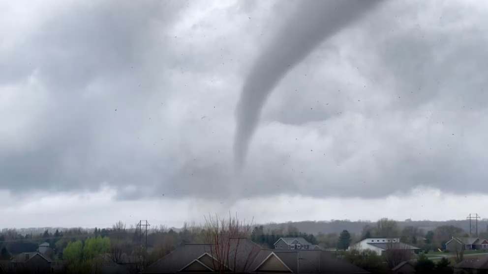
A few spots are watching for more. The National Weather Service issued a flood watch for the Blue Ridge through late Sunday night, with central Virginia expected to see the most rain. There’s also a small tornado risk worth knowing about. The local 7News team noted that tropical remnants can sometimes produce brief spin-up tornadoes, especially in stronger rain bands. It’s low, but it’s real, and it’s most likely southeast of the city according to the Capital Weather Gang’s earlier outlook.
Outdoor plans took a hit. Forecasters told anyone heading to the Washington Commanders’ home game or the Army Ten-Miler to pack rain gear, since the rain could be heaviest at times.
The rest of the week in D.C.
Better days are coming. Monday should see showers end early, then clouds giving way to sun, with a high near 73. Tuesday and Wednesday look mild, with highs around 80. Some forecasts are even warmer midweek. AccuWeather’s look-ahead listed an 88-degree high on Wednesday and then a noticeably cooler Thursday. Forecasters don’t agree on the exact numbers, so check back as it gets closer. NBC Washington’s outlook also pointed to a chilly weekend ahead.
“Weather near me”: how to get the most accurate forecast
Searching “weather near me” gets you something quick, but a few habits make it much more useful.
Start with the National Weather Service at weather.gov, where you can type in your ZIP code. It’s the source for official watches and warnings, and many apps pull from it. Turn on emergency alerts on your phone so you don’t have to catch warnings by luck. Compare the hourly forecast rather than just the daily high, because a storm like Isaias can mean a dry morning and a miserable evening. And if you’re in a spot that floods easily, like an underpass, a low street or a basement apartment, decide ahead of time where you’ll go.
For travelers heading to the Southwest, check park and road alerts before driving anywhere. Washes that are dry at 10 a.m. can be rivers by 2 p.m., even if it isn’t raining where you’re standing.
The bottom line
Rachel’s remnants are the bigger danger today, particularly for flash flooding in the desert Southwest and for coastal flooding along the Southern California shoreline. Isaias’s remnants are mostly a nuisance in the D.C. area, though they could still cause ponding, local flooding and gusty winds. Both storms should move out by early next week.
Keep updated with https://www.weather.gov/